Male’, Maldives – The European Space Agency’s Copernicus Sentinel-3 mission released a stunning image of the Maldives from space.
According to the ESA “The main objective of the Sentinel-3 mission is to measure sea surface topography, sea and land surface temperature, and ocean and land surface colour with high accuracy and reliability to support ocean forecasting systems, environmental monitoring and climate monitoring.”
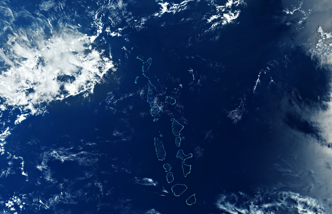
The image was made possible by the ocean and colour instrument onboard the Copernicus Sentinel-3 mission, which has a swath width of 1,270 km that has allowed the one of the most geographically dispersed countries and its surroundings to be captured.
Different cloud formations can be observed scattered around the image, and while clear view of the Maldivian archipelago is often obscured by clouds, making this practically cloudless image remarkable, even though Huvadhu Atoll and Addu Atoll are partially covered by clouds. The picture also shows the southernmost tip of India, 700km northeast of the Maldives in the top right corner.
Another Satellite the Copernicus Sentinel-6 Michael Freilich, is scheduled for launch on the 10th of November. Lengthy climate records are required in order to better understand the impact rising seal levels on humanity and the Copernicus Sentinel-6 will continuing be the long-term record of measurements of sea-surface height that dates back to 1992 .The continuation of this time series, will allow for invaluable climate research and help scientists monitor the consequences of climate change.
The Special Report on the Ocean and Cryosphere in a Changing Climate theorizes that the global average sea level is likely to rise by approximately 1 metre by 2100, and with more than 80 percent of Maldives’ land area being less than one metre above mean sea level, most of the Maldives faces the threat of submersion.